
Corridor Mapping
Linear corridor mapping for roads, pipelines, transmission lines and canals — long, narrow strips mapped efficiently for routing and design.
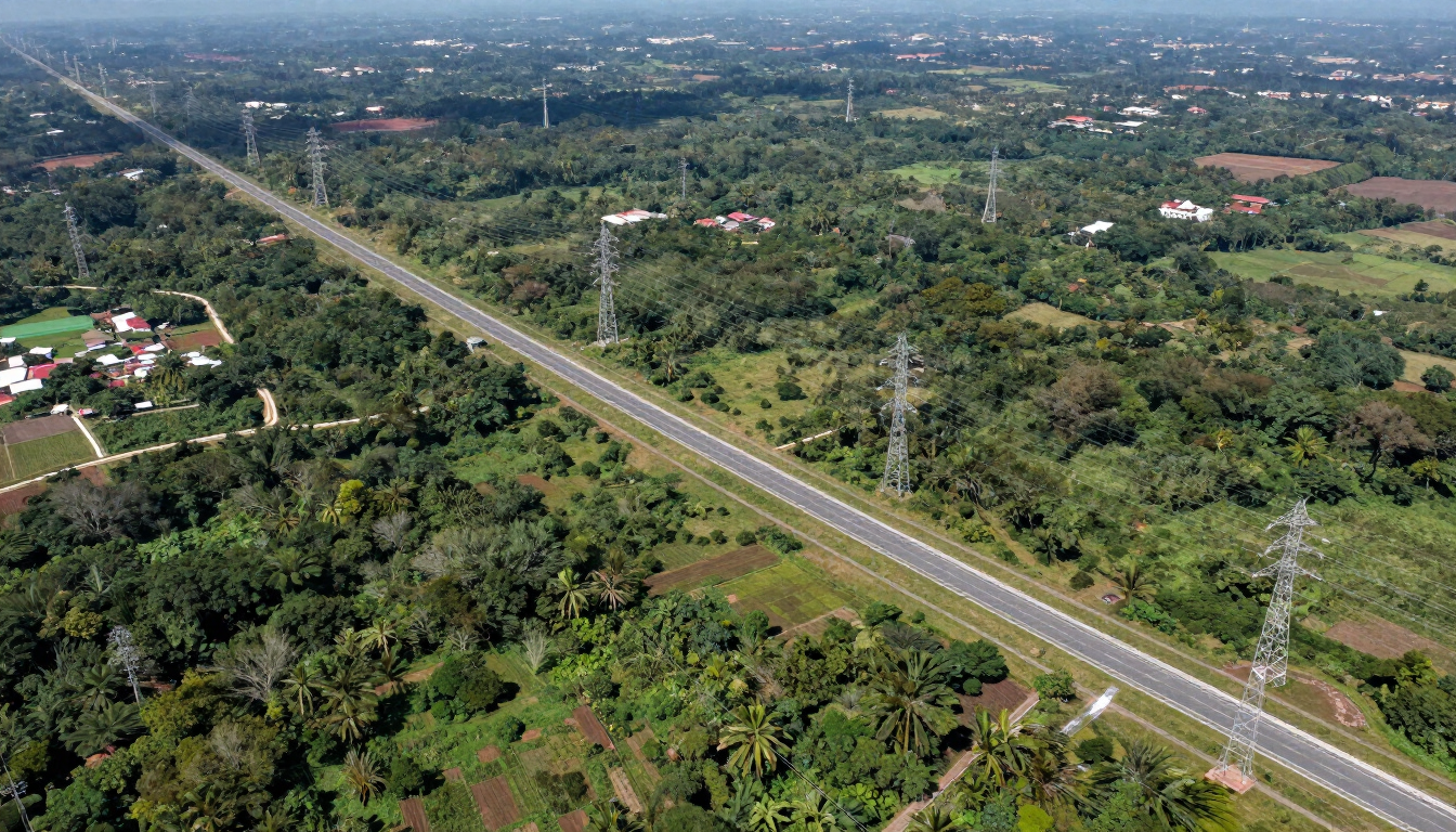
Corridor mapping surveys long, narrow strips of land — roads, pipelines, transmission lines, canals — efficiently producing the continuous base mapping that linear infrastructure routing and design require.
Overview
Linear infrastructure — a road, a pipeline, a transmission line, a canal — runs along a corridor that can stretch for kilometres but is only tens of metres wide. GLONAS maps these corridors efficiently with UAV photogrammetry and LiDAR, producing a continuous orthophoto, DEM/DSM and feature map along the full alignment without the gaps and inefficiency of scattered point surveys. The output supports route selection, engineering design, environmental and land-take assessment, and construction planning along the entire corridor. Ground control is placed along the route to maintain accuracy over long distances, and the deliverable is a single, continuous base mapping dataset that follows the alignment end to end. It is the foundation for any linear project that needs a consistent, measured picture of what it passes through.
Scope of Services
- Linear UAV photogrammetry and LiDAR capture
- Continuous orthophoto and DEM/DSM along alignment
- Route selection and comparison mapping
- Land-take and environmental corridor assessment
- Feature and obstruction mapping
- Construction planning base map
Key Benefits
- Continuous end-to-end corridor map
- Efficient long-strip capture
- Route & land-take support
- Consistent accuracy over distance
Applications
- Road and highway corridors
- Pipeline and canal routes
- Transmission line corridors
- Linear infrastructure planning
Industries
- Infrastructure
- Energy
- Oil & Gas
- Construction
- Government
Methodology
Plan the corridor and ground control along the alignment, capture UAV photogrammetry and LiDAR in efficient strips, process a continuous orthophoto and DEM/DSM, map features and obstructions, and deliver a corridor base mapping dataset.
Equipment / Technology
UAV photogrammetry and LiDAR, RTK GNSS corridor ground control, linear processing tools.
Deliverables
Technical Specifications
Methods: UAV photogrammetry + LiDAR | Output: continuous orthophoto + DEM/DSM + features | Linear
Workflow / Process
1. Corridor & ground control planning
2. Linear UAV capture
3. Continuous orthophoto & DEM/DSM
4. Feature & obstruction mapping
5. Corridor dataset delivery
FAQ
Q: Can you map a corridor tens of kilometres long?
A: Yes — efficient linear UAV capture with corridor ground control produces a continuous map over long distances.